Access census-tract data to power research on social and environmental determinants of health
University of Southern California (USC)
Children's Hospital Los Angeles (CHLA)
Los Angeles County Department of Health Services (LAC DHS)
Goal:
Use Informatics-Based Research Tools and Services
Service description
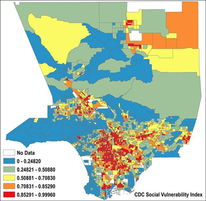
In collaboration with the Spatial Sciences Institute at USC, the SC CTSI provides services for investigators with an interest in linking geospatial and patient health data. We help researchers access census-tract-level data such as exposure to environmental risk factors (e.g., air and water quality metrics), socio-economic and environmental conditions (e.g., median income, education, access to food), and neighborhood demographics (e.g., population density, race, ethnicity). Incorporated into research datasets, these data can power research on social and environmental determinants of health without the need to disclose patient addresses. SC-CTSI/CRI and ISI staff can consult with teams interested in these data in their research, to understand the nuance of these variables in context.
42 social and environmental measurements from 6 different data sources (e.g., CDC, Cal EPA, ACS/US Census Bureau) are available, including:
Researchers can also obtain patient-level social and environmental health data by submitting a request to our CRI Service Hub.
Click here to view the FAQs for research data requests, tools, and other informatics services.
Cost
An initial one-hour free consultation is provided to assess project needs, identify appropriate services, and determine the number of hours or level of effort required for the project. Any additional consultation time will be provided on a recharge basis. Investigators may qualify for free consultation hours through one or more of the categories below; however, the maximum number of free consultation hours available per investigator across all projects per fiscal year is 9, including initial consultation hours. Following the initial consultation, investigators will receive a recommended scope of work and cost estimate.
Rates
I2B2 is free to search.
Data Request rates:
Service Model
Non-Industry
Industry
Hourly Rate
$125/hour
$150/hour
Effort-Based Rate
$186,900/year (100% effort)
$233,625/year (100% effort)
**Rate includes salary & fringe
Pricing & Billing Notes
The rates shown are blended rates for SC CTSI services and reflect the combined cost of personnel, expertise, and operational support required to provide the service.
The rates shown include all applicable salary and fringe benefit costs.
Services are billed as “Other Materials and Supplies (SC0243)” through the USC Priority Software FBS platform monthly.
Non-industry rates apply to academic, government, foundation, and non-profit funded research projects and are partially subsidized by SC CTSI.
Industry rates apply to research funded or sponsored by commercial, for-profit organizations, including pharmaceutical, biotechnology, and medical device companies.
Annual effort-based rates represent 100% effort; costs are prorated based on the level of effort requested and the project duration.
Organizations outside of USC and CHLA are subject to an additional 30.5% indirect cost (overhead) rate on professional service agreements.
For grant-funded projects, investigators are encouraged to engage the DS Team during proposal development to ensure adequate resources are budgeted for community engagement activities.
Discount Categories: Eligibility for discounted services is determined by the CRI Consultant. Investigators may qualify for free consultation hours through one or more of the categories below based on their role in the associated IRB protocol, funded award, or project. However, the maximum number of free consultation hours available per investigator across all projects per fiscal year is 9 hours, inclusive of initial consultation hours.
Initial Consultation (up to 1 hour per project): Free for projects based at USC, CHLA, and affiliated SC CTSI institutions.
SC CTSI Pilot Funding Awardees (up to 2 hours per fiscal year): Investigators with an active SC CTSI Pilot Funding award may receive up to 2 hours of support for activities related to the funded project.
Junior Investigators (up to 9 hours per fiscal year): Junior investigators, as defined by NIH policy and listed on the approved IRB protocol as an Investigator or Co-Investigator, may receive up to 3 hours of support per unique IRB protocol, with a combined maximum of 9 hours across all protocols per fiscal year.
K Awardees (up to 15 hours per fiscal year): Investigators with an active K award may receive up to 15 hours of support per fiscal year for their K award project based at USC, CHLA, and affiliated SC CTSI institutions.
Extramural Grant Planning (up to 3 hours per fiscal year): Investigators preparing an extramural grant application may receive up to 3 hours of support for grant planning and proposal development. To qualify, the proposal must be submitted within six months and include at least 5% budgeted effort for CRI data services